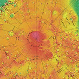
Sky & Telescope's Mars Topography Globe
Explore the Red Planet's highest volcanoes, largest impact basins, and deepest canyons with this updated 12-inch-diameter topographic globe of Mars. Derived from millions of laser-altimeter measurements by NASA's Mars Global Surveyor orbiter, this data set has revolutionized our understanding of Martian geology. Elevations are color-coded for easy identification, and more than 150 surface features are labeled with their official names. This updated globe includes the landing sites for the Spirit, Opportunity, Phoenix, and Curiosity rovers.
Mars should be nicknamed the Lumpy Planet because it displays such a wide range of highs and lows — and S&T’s topography globe uses a color scheme to show these elevation changes. For example, the white summit atop the Olympus Mons, the solar system’s largest known volcano, indicates that it is nearly 22 km (72,000 feet) high — 2½ times taller than Mount Everest! The white summit gives way down its flanks to brown, pink, and finally yellow, before flattening out into the green of Lycus Sulci and, farther west, the rich blue of the deep regional depression Amazonis Planitia.
Did You Know?
Hellas Planitia, a huge blue-and-purple feature on S&T’s Mars Topography Globe, is the solar system’s largest visible impact basin. It’s 2,300 km (1,400 miles across)!
ISBN 13: 9781940038674


